
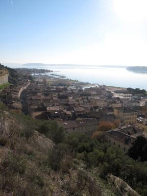
Saint-Chamas : Du port au "Delà"
Sport, Pedestrian sports, Hiking itinerary
in Saint-Chamas
3.6
km
1h 30min
Medium
-
Discover Saint-Chamas: the history of the village at the Paul Lafran Municipal Museum, the wealth of flora and fauna in the Parc de la Poudrerie, the Parc des Creusets and the Petite Camargue, not forgetting the not-to-be-missed Pont Flavien.
- Departure
- Saint-Chamas
-
-
Difference in height
- 62.0167 m
-
-
-
Plain text period
- All year round.
-
-
-
Documentation
- GPX / KML files allow you to export the trail of your hike to your GPS (or other navigation tool)
-
-
-
Accepted customers
-
- See all reviews
- 62 meters of difference in height
-
- Maximum altitude : 50 m
- Total positive elevation : 62 m
- Total negative elevation : -62 m
- Max positive elevation : 30 m
- Min positive elevation : -31 m
